Ballyrush
- Michael Burns

- Aug 27, 2024
- 2 min read

Ballyrush is out towards Ballygowan town, bordering the townland of the same name and encompassing significant portions of both the Ballygowan & Old Ballygowan Road. It stretches to 0.84 of a square mile or around 540 acres.
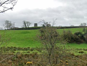
Ballyrush comes from the Irish Baile an Rois meaning a wooded height or promontory. While the wood has now long since vanished, it is still quite a hilly area with the Ballygowan winding through hills on either side (one now topped with a Wind turbine rather than a trees.
Within Ballyrush, there are two archaeological sites highlighted on the NI Sites & Monuments Record an enclosure (of which only traces remain, [DOW010-048] and a scheduled Rath, which can be clearly seen from the Ballygowan Road [DOW010-049]. This Rath is an excellent example of an Early Christian (500-1100AD) Trivallite Rath- trivallate meaning that it had three massive banks and ditches surrounding it. These sites are set apart from other raths, which generally only have one or two defensive mounds/ditches, therefore given the extra work taken to create a Trivallate rath- they are generally seen as belonging to people of importance to the local area. Perhaps, Ballyrush Rath was the home of some long forgotten local chieftain?
Just next to Ballyrush Rath and belonging to the landowners of the Rath is Hill Head [HB24/16/030], a B2 listed Georgian farmhouse built around 1820. Supposedly built by James Montgomery who owned the house until at least 1863, later coming into the hands of the Patterson family. The façade and basic interior layout surprisingly remains largely unaltered, with the some original detailing noted to survive. Further along the Ballygowan Road towards Comber and on the opposite side, the remains of a Flax Windmill can also be seen, flax was of course the key crop needed within the manufacturer of linen.


Comments